New research finds Mississippi River losing most of its sediment before reaching Gulf
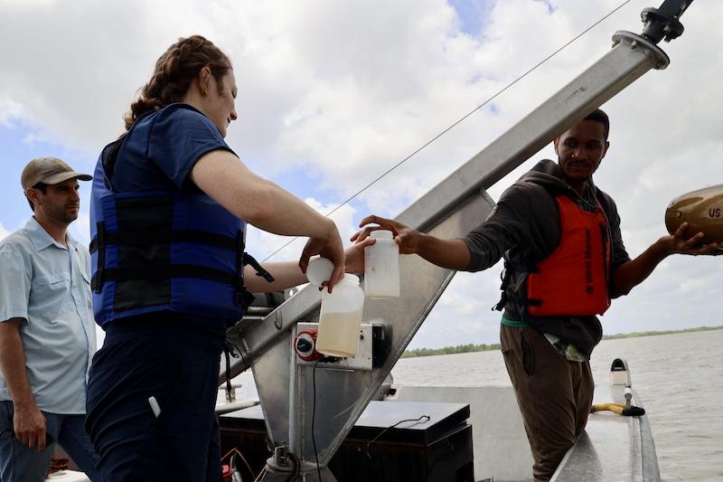
Tulane University researchers are spending days at a time on the Lower Mississippi River collecting water samples by boat to better understand water and sediment flow in the region known as the Bird’s Foot Delta, the southernmost tip of the river that juts out into the Gulf.
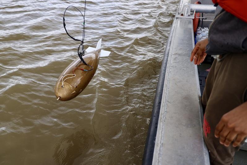
Their work involves plunging a 200-pound isokinetic sediment sampler into the river at various depths to measure river discharge, then using that information to build numerical models to test ways to save the Bird’s Foot. They are working to find out how much sediment remains in the wetlands above water versus how much exits into the deepwater Gulf.
The fieldwork is part of the five-year, $22 million Mississippi River Delta Transition Initiative (MissDelta) being co-led by Tulane and Louisiana State University and funded by the National Academies of Sciences, Engineering and Medicine.
The goal is to predict what will happen to the delta by 2100 under different future scenarios, such as sea level rise, storm frequency and river flow, and evaluate potential management solutions by testing different interventions, like closing river exits and changing water flow patterns, to allow the Bird’s Foot to remain.
Using that information, researchers can then assess socio-economic impacts of these interventions on local communities and economies and ultimately provide science-based recommendations to decision-makers at the local, state and federal levels for sustaining the region's vital ecosystem and economy in the face of multiple environmental threats.
They also aim to attract and educate the next generation of coastal problem solvers from K-12 to post-graduate.
"Right now, we don't know very much about where the sediment is in the Lower Mississippi River, and so understanding how much is leaving verses how much is staying and making it all the way to Southwest Pass will help us calibrate models, and it's just useful for everyone, like people studying vegetation," said Claire Kemick, a Tulane graduate student working with researchers to collect the samples.
Data collected in the first year-and-a-half reveal that during most river conditions, less than 10% of sediment flowing down the Mississippi reaches the Gulf through the three main passes. Substantial amounts are instead lost above heads of passes, exiting through both natural and human-made channels. Sediment loss is especially high during low or average river flows.
“These findings demonstrate the Bird’s Foot is on a degradational trajectory despite much of the river’s sediment being deposited upriver of the deep-water Gulf outlets,” said Mead Allison, a professor in Tulane’s Department of River-Coastal Science and Engineering, who is co-leading the effort with Samuel Bentley of LSU.
“In addition to projecting the future for the Bird’s Foot landmass, we are also interested in what happens to the wetland and what happens to fish, and how does that reverberate up into the local economy? What does that mean for jobs? What does that mean for flooding and for the overall sustainability of communities both here and further inland?” Allison said.
The researchers are conducting field studies at various river discharge levels to calibrate their models. During high discharge periods in the spring, they track water loss through different exits, both natural and human-made. During low discharge periods in the early fall, they study salt wedge movement into the river.
The goal is to find management approaches that benefit both the ecosystem and the people who live and work in the delta region, Allison said.
Preliminary results from the first year-and-a-half of the five-year initiative reveal substantial water losses above head of passes through multiple exits, with less than 10 percent of the river's sediment load reaching the Gulf through the three main passes except during extremely high discharges, Allison said.
Allison and his team of graduate students from Tulane and the University of Louisiana at Lafayette are collecting sediment samples during high river discharge, and in the fall, they will study saltwater intrusion, which is taking place through multiple exits beyond the Southwest Pass navigation channel and complicating drinking water issues for the greater New Orleans area.
The follow-up expedition will focus on low-flow conditions when salt wedges are present in the river, aiming to improve predictive models and to develop solutions to avoid imperiling future drinking water supplies.
The Lower Mississippi Delta serves as a critical navigation access point for North America, supporting extensive energy infrastructure, commercial fisheries and wildlife preserves. Its wetlands protect adjacent communities from hurricane surges, while its daily shipborne commerce is valued at approximately $300 million and includes 60 percent of U.S. global grain exports.
Allison is one of nine Tulane scientists who are serving as principal investigators on the project and are attacking a varied set of questions including predicting changing Mississippi River discharge, quantifying sea level rise and coastal subsidence and increasing wetland sustainability.
Besides Tulane and LSU, the Miss Delta consortium includes researchers from a dozen other colleges and universities across the southeastern U.S., including Xavier University, Southern University, the University of Louisiana at Lafayette, the University of Southern Mississippi, the Water Institute of the Gulf in Baton Rouge and Dillard University, among others.


